Much of Savannah sits on Pleistocene-age terrace deposits and younger marsh sediments, with a shallow water table rarely deeper than six feet near the coast. Any excavation deeper than a crawlspace or grading steeper than 2H:1V in these low-strength soils triggers a closer look at stability. The city’s subtropical climate delivers over 49 inches of rain a year, saturating the upper silty sands and accelerating erosion in drainage swales. When a developer re-grades a lot along the Vernon River or cuts into a sandy bluff near the Ogeechee, the risk of a rotational failure jumps sharply. We run limit-equilibrium analyses that incorporate pore-pressure buildup from the shallow aquifer and the loose-to-medium dense sands mapped across Chatham County. For deeper cuts in the underlying Hawthorn Formation, we often combine the stability model with a cone penetration test to define weak clay seams that don’t show up in standard borings.
In Savannah’s saturated coastal soils, a slope that stands dry can fail within 24 hours of a tropical storm if the analysis ignores transient pore pressure.
Process and scope
Local ground factors
In Savannah, the typical culprit is a contractor digging a trench for a foundation wall during a damp August week and leaving it unshored overnight. A vertical cut of 12 feet in moist silty sand is not long-lasting; the suction maintaining the face disappears within a few hours, leading to slumping in the lower section. We employ a tracked CPT unit to penetrate the loose upper soils behind the crest and precisely locate the groundwater level relative to the cut face. On a recent job near White Bluff Road, a planned 15-foot excavation for a stormwater vault needed a temporary slope ratio of 1.5 horizontal to 1 vertical along with dewatering wells, because the factor of safety fell below 1.1 without them. Given that Savannah's geology provides little leeway, the stability analysis must incorporate the rainfall scenario designated as the probable maximum by the IBC, not merely the average month.
Reference standards
Key codes and standards applied are IBC 2021 Chapter 18 (dealing with soils and foundations), ASCE 7-22 Section 11.8 (covering seismic slope stability), ASTM D3080 (for direct shear tests), ASTM D4767 (for consolidated-undrained triaxial), and FHWA-NHI-05-123 (on soil slope and embankment design).
Other technical services
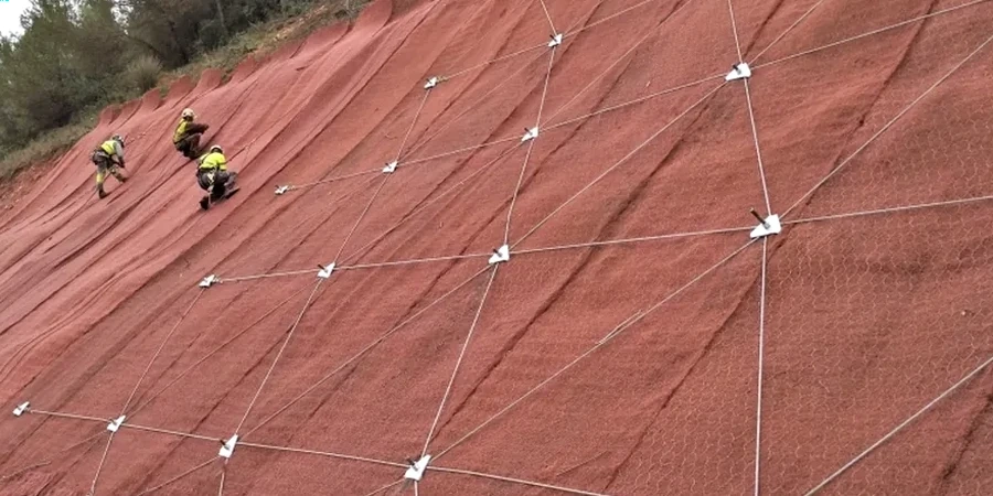
Limit-Equilibrium Slope Modeling
Construction of 2D cross-sections relies on Spencer's method and Bishop simplified routines, which are calibrated using shear-strength data obtained from undisturbed Shelby-tube samples collected in the field. The simulation incorporates the perched water table that frequently occurs in Savannah's interbedded sands and clays, and we conduct sensitivity analyses regarding the fill weight permissible behind a bulkhead or retaining wall to avoid a deep-seated failure.
Cut-and-Fill Stability Review
For sites needing benching into a natural slope or the placement of engineered fill atop soft marsh clay, we assess both short-term undrained and long-term drained scenarios. The reports detail compaction specifications, reinforcement layers, and bench geometry in compliance with the City of Savannah's grading ordinance and IBC Chapter 18 requirements.
Typical parameters
Frequently asked questions
How much does a slope stability analysis cost for a residential lot in Savannah?
The cost for analyzing a single-family lot with a proposed cut or fill not exceeding 10 feet generally ranges from US$1,300 to US$4,410, with the variance depending on the need for additional CPT soundings or lab shear tests. For a more involved commercial site featuring multiple cross-sections and instrumentation suggestions, the price tends to be at the higher end of that bracket.
What triggers the City of Savannah to require a slope stability report?
A geotechnical report containing a slope stability section is required by the city's Development Services Department if grading involves more than five feet of cut or fill, if the proposed slope exceeds a ratio of 2 horizontal to 1 vertical, or if construction takes place within 50 feet of a designated floodplain or marsh edge. This document must be stamped and signed by a professional engineer licensed in Georgia.
Can you analyze slopes in the soft marsh clays along the Savannah River?
Indeed, for soft clays, an undrained analysis is needed for short-term conditions, while an effective-stress analysis addresses long-term settlement. Our sampling uses thin-wall Shelby tubes, we perform consolidated-undrained triaxial tests, and we model the slope using staged construction to accommodate pore-pressure dissipation over time.
How do you account for hurricane rainfall in the stability model?
The rainfall input is the 24-hour, 100-year depth from NOAA Atlas 14 for Chatham County, approximately 8.5 inches. This value is applied in the model as a steady-state seepage condition with complete saturation of the upper soil layers, and we evaluate the factor of safety during the storm's peak when pore pressures are at their maximum.
Do you provide construction-phase monitoring for slopes in Savannah?
A monitoring plan can be established incorporating slope inclinometers, piezometers, and survey markers, with site visits scheduled at critical times like following intense rainfall or during significant excavation phases. The collected data enables us to confirm that the slope behaves as expected and to modify dewatering or shoring arrangements if necessary.